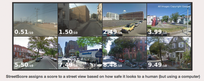


StreetScore is an interesting project created by a small group of MIT students that assigns a numerical score to Google’s Street View images, based on how safe it looks to a human — but using a computer algorithm.
The original data came from a crowdsourced visual survey of images where users score their feelings (try it for yourself) of how safe an image makes them feel (see example image/results below for a better idea of how images were scored). That data was then loaded into the computer where it could be interpreted through the algorithm the team has developed and output into color coded maps as seen on the StreetScore home page.

This type of data interpretation could potentially change how buyers choose which neighborhood they’d like to purchase in, similar to what WalkScore has done over the past five years for neighborhood “walkability” scores, and possibly be included in future iterations of home valuation products that some Realtors are using for lead capture purposes.
At the time of writing, StreetScore is available in select cities (New York, Boston, Chicago, and Detroit) but according to the statement on their website, they’ll be rolling out a new city each week as more images are run through the visual survey.
The post StreetScore: how safe are streets in your neighborhood? appeared first on WFG’s Tech Talk.
The post StreetScore: how safe are streets in your neighborhood? appeared first on WFG National Title Insurance Company.


